Ashim Sharma
I'm Designer
About
Hello! I’m Ashim Sharma, a passionate engineer and licensed surveyor based in Nepal. With a strong academic background in GIS, remote sensing, photogrammetry, I bring innovative spatial solutions to real-world challenges. Currently, I serve as the Head of Department (HoD) of Civil and Geomatics Engineering at Rajhena Technical College while also offering freelance geospatial services.

Personal Information
- Birthday: 31 August 1997
- Website: www.ashimsharma.com.np
- Phone: +977 9844951267
- City: Ghorahi, Dang, Nepal
- Age: 28
- Degree: Bachelors
- Email: [email protected]
- Freelance: Available
If you want to work with me, have an interesting project I could join or just want to say hi, feel free to email me or add me as a connection on Linkedin.
Skills
Highlighting Key Competencies and Technical Expertise
Resume
Key Milestones in My Career, Education, and Technical Expertise
Summary
Er. Ashim Sharma
With over 4.5 years of experience as Geomatics Instructor, currently working as Head of Department in the Civil and Geomatics Engineering Department at Rajhena Technical College leading both academic and hands-on training in the field. Experience also includes working with remote sensing and GIS technologies, focusing on spatial data analysis and mapping to drive impactful geospatial projects.
- Jyotinagar Tole, Ghorahi-15, Dang, Nepal
- (+977) 9844951267
- www.ashimsharma.com.np
Education
Bachelor in Geomatics Engineering
2015 - 2019
Kathmandu University, Dhulikhel
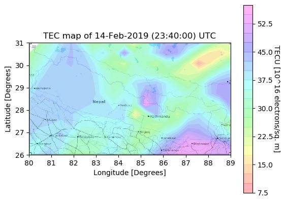
Thesis: Preparation of Ionospheric Model (TEC Map) of Nepal Using CORS Data
Professional Experience
HEAD OF DEPARTMENT (COORDINATOR)
2020 - 2025
Rajhena Technical College, Ghorahi
- Overseeing staffs, organizing programs and facilitating the program's effective management.
- Guiding students and faculty in the application of surveying, GIS, and geospatial technologies
- Managing departmental projects and collaborations to enhance research and development in geomatics engineering
GIS Analyst
2019 - 2020
Bhugol Engineering Consultant Pvt. Ltd., Kathmandu
- Designed and analyzed spatial data using GIS tools.
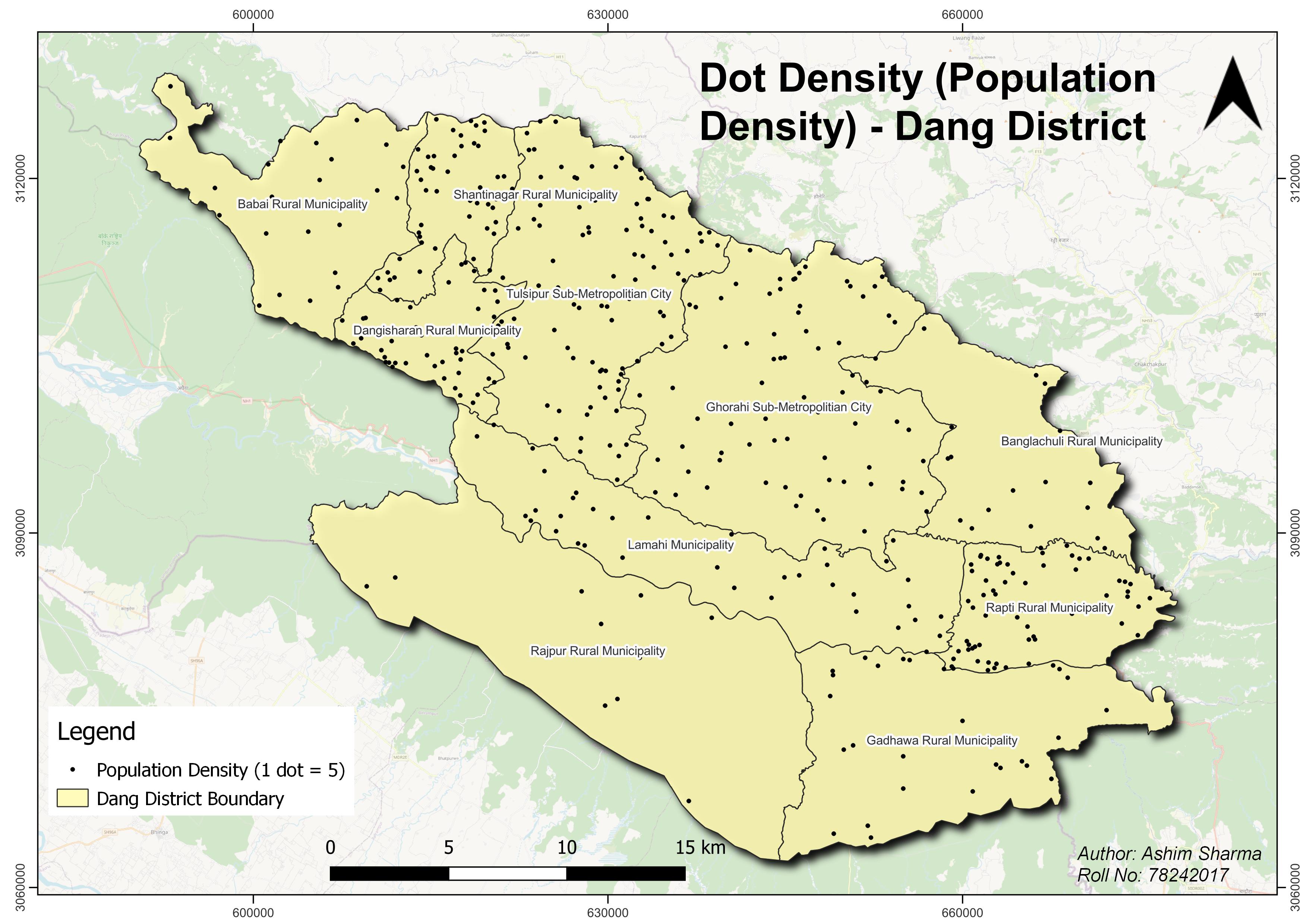
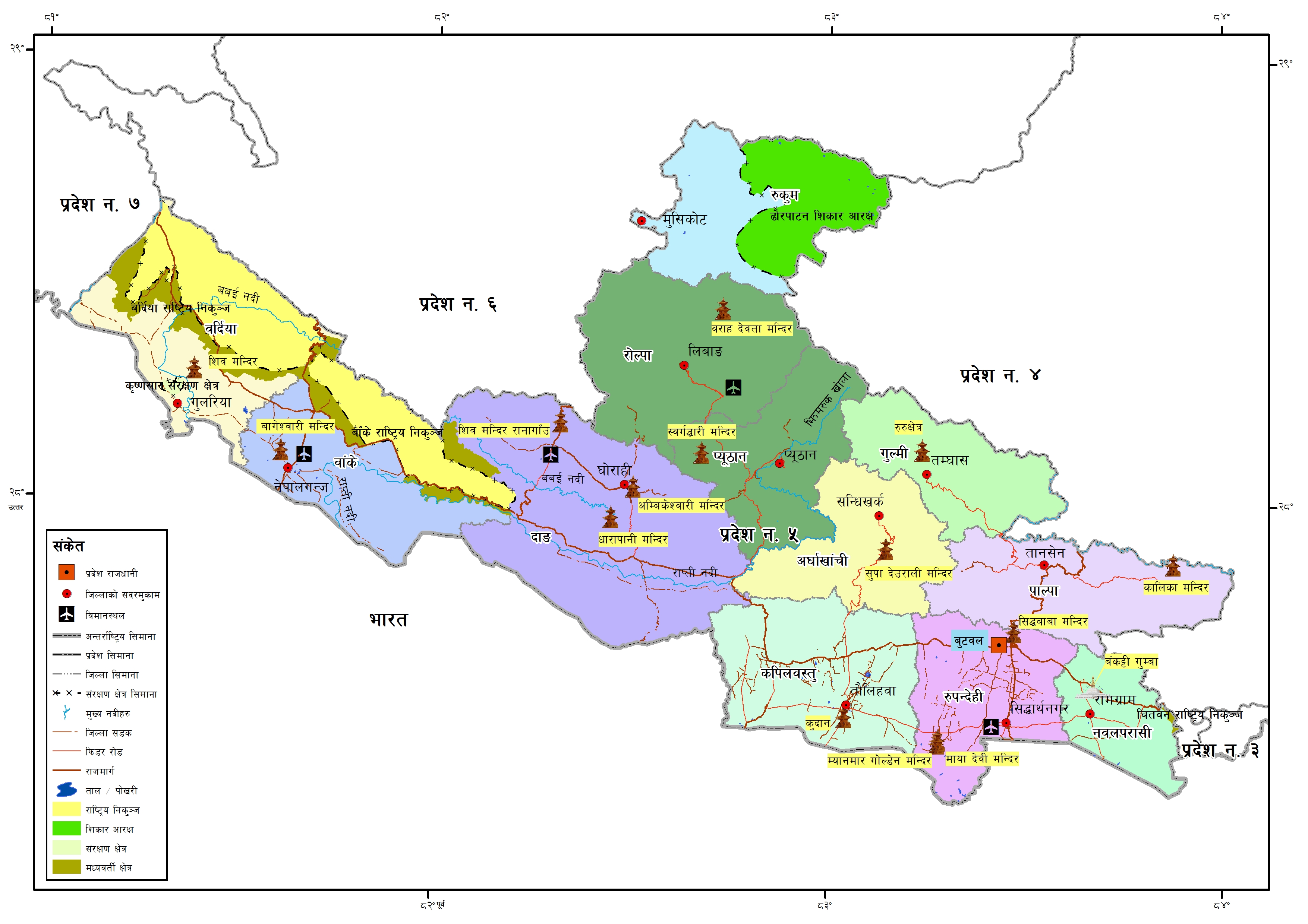
- Created administrative maps of Nepal’s provinces and districts
- Contributed to geo-database development and municipal-level land use mapping
Portfolio
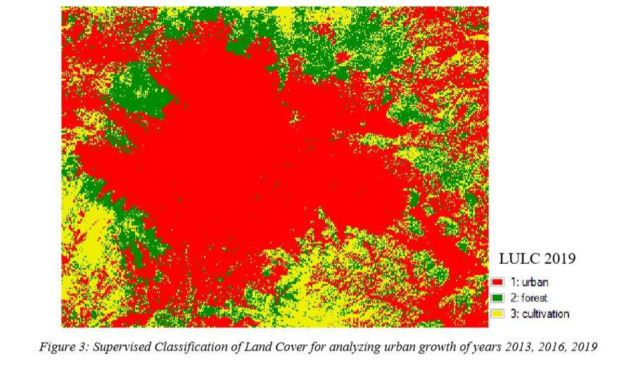
Some of the key projects I have worked on during my academic and professional journey in geomatics engineering.
- All
- Major Projects
- Maps
Resources
Welcome to the resource hub — your one-stop destination for quality learning materials. Here you'll find curated notes, guides, and downloads to help you thrive in your academic journey and professional career. Everything here is free, relevant, and crafted with your success in mind.
Aadhur Bhut Surveykshan (Madhu Sudhan Adhikari)
Comprehensive objective based books for PSC Aspirants.
DownloadLevelling Instruction Book (Red Book)
Levelling Instruction Book prepared by Department of Survey.
DownloadTriangulation Instruction Book (Blue Book)
Triangulation Instruction Book prepared by Department of Survey.
DownloadHighlights
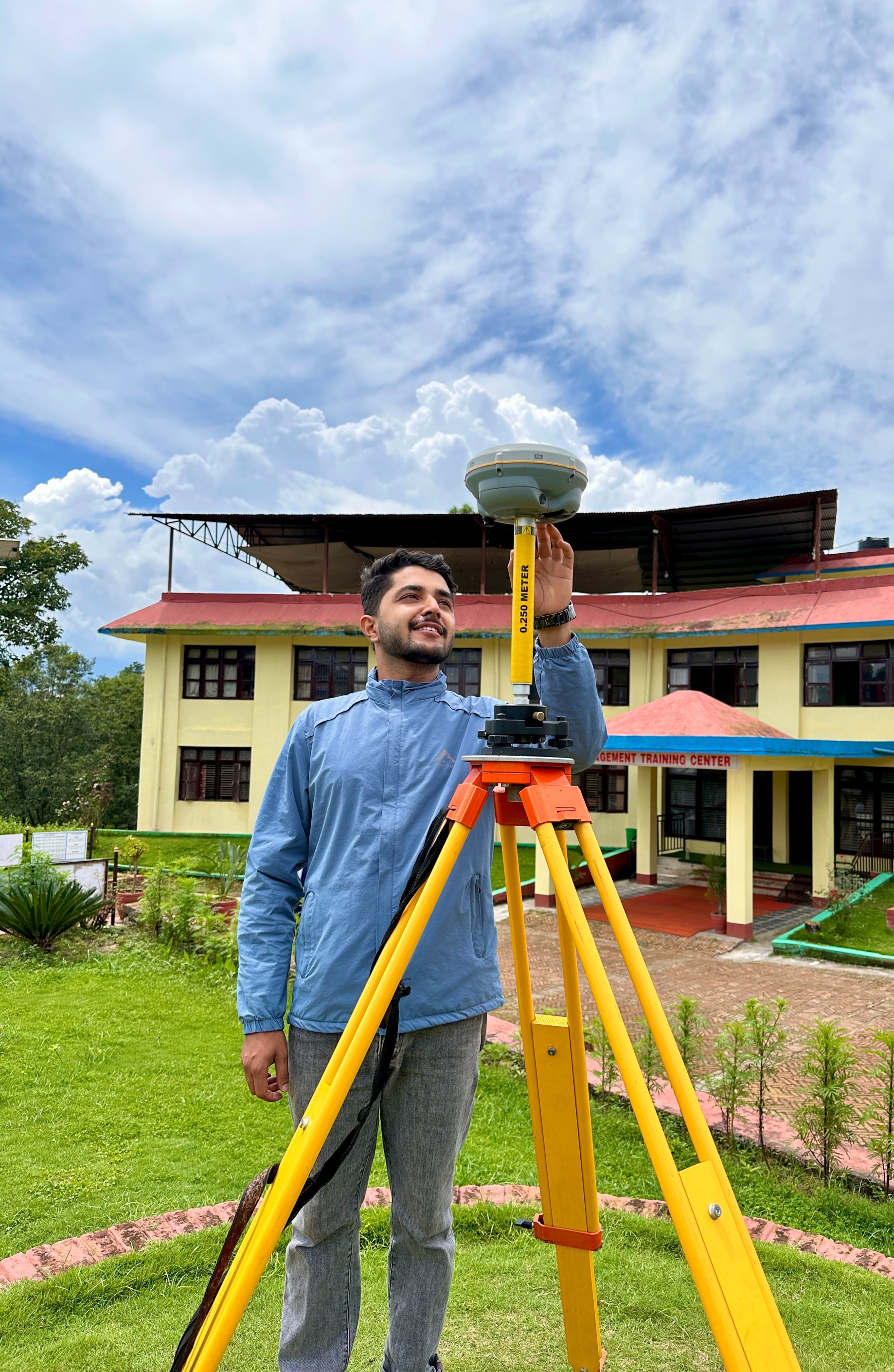
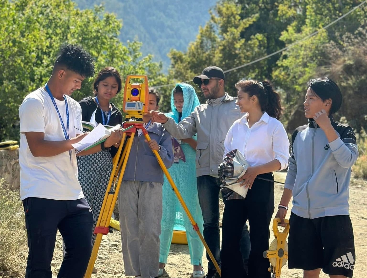
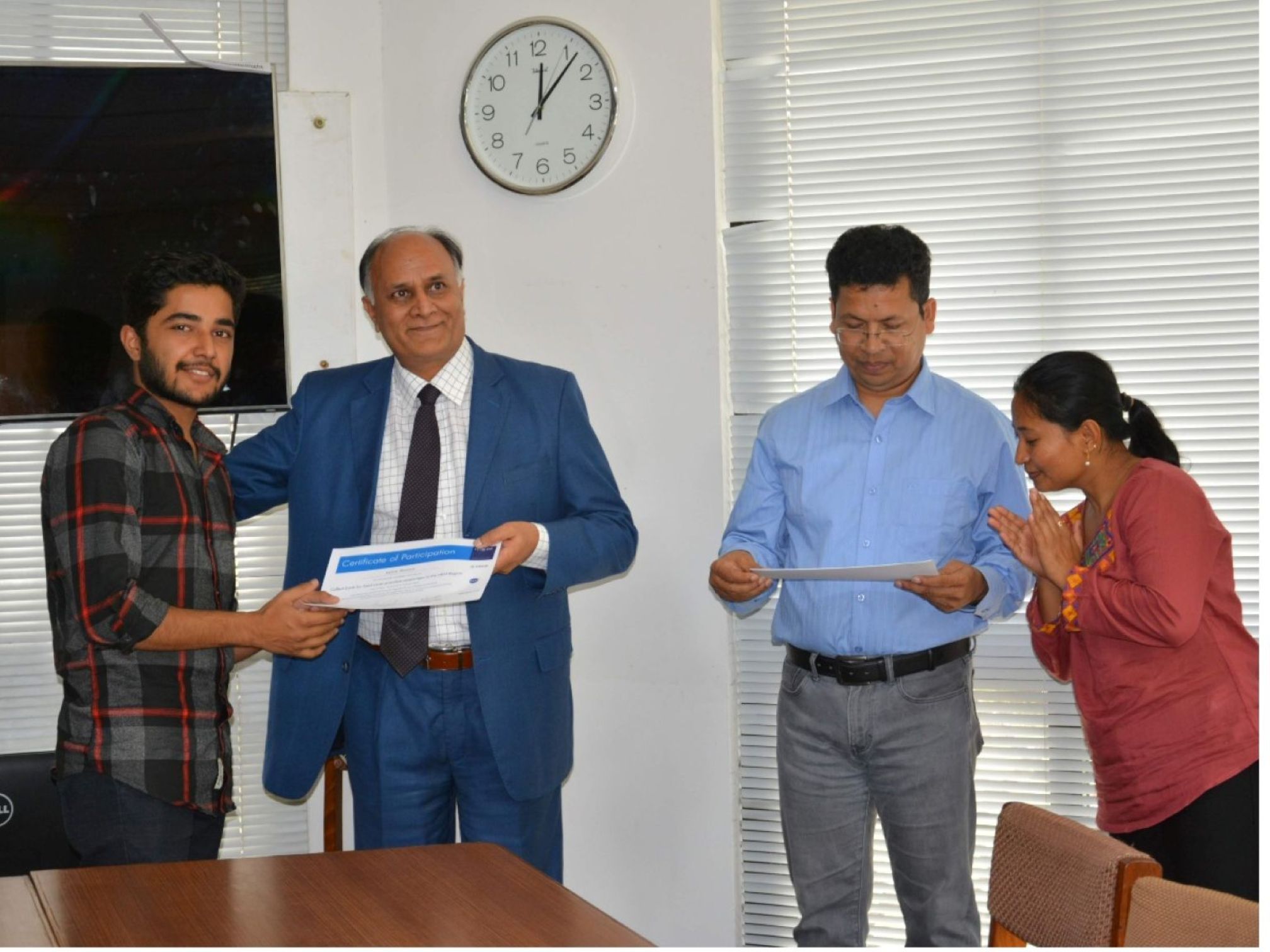
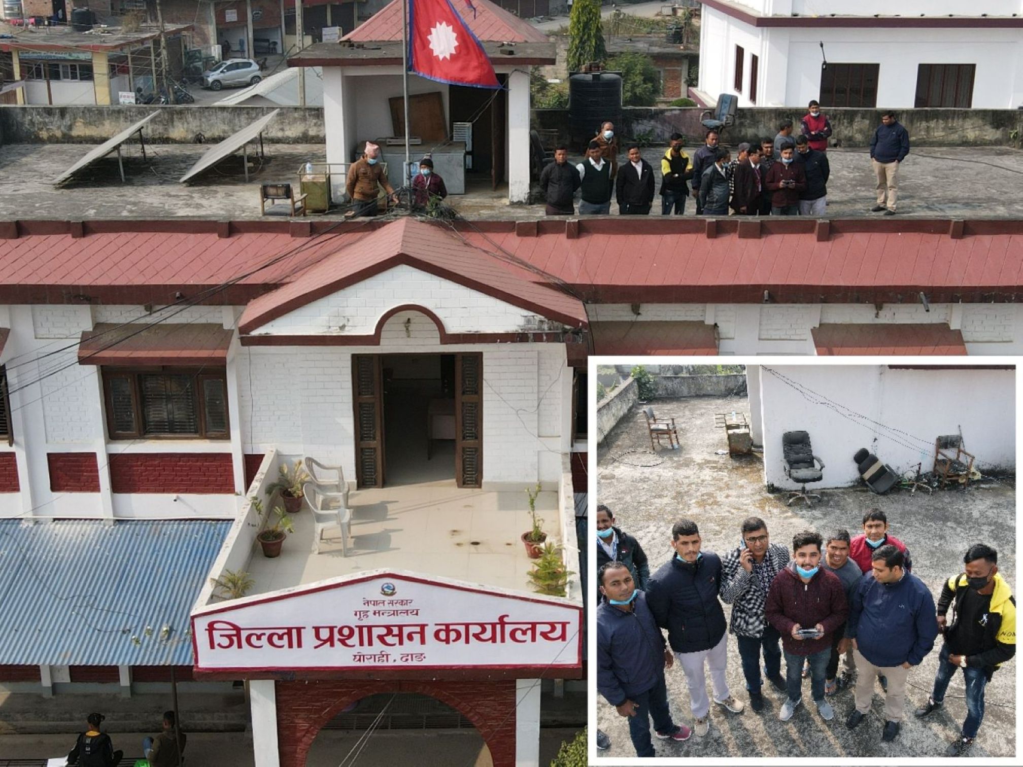
A glimpse of practical fieldwork and project involvement during my surveying journey.
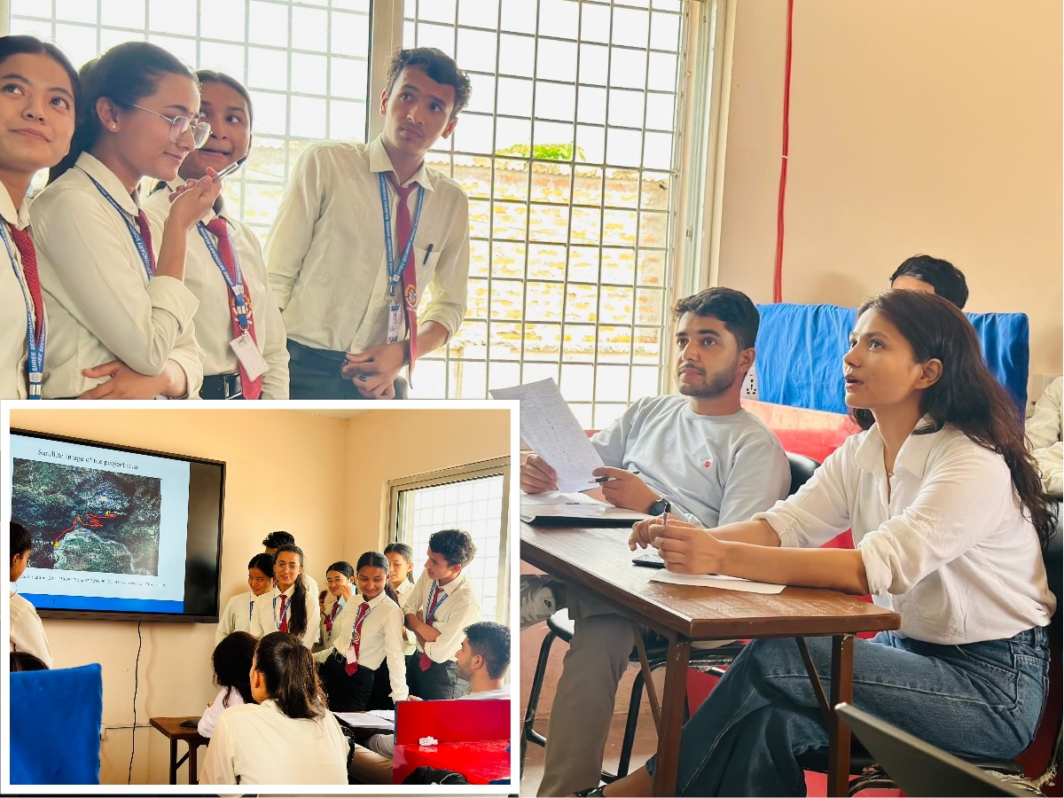
Evaluating research projects of students at Rajhena Technical College
Field surveying using total station in hilly terrain of Rolpa
Training on Development of NLCMS of Aghanistan during ICIMOD intern.
Drone Disaster Monitoring under District Administration Office, Dang
Contact
Whether it's a project, a query, or just a hello — drop a message and I’ll get back to you soon.