
Portfolio Details
Project information
- Category: Experimental Findings
- Purpose: Educational Research
- Project date: 2019
- Project DOI: 10.13140/RG.2.2.13951.43686
Project Description
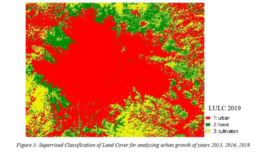
This study has incorporated remotely sensed Landsat data with remote sensing techniques in order to effectively quantify the spatial extent of urban growth and its impact on the land surface temperature in Kathmandu Valley, Nepal. In this project, we performed supervised classification and change detection to determine the spatial trend of land use and land cover change. After that we obtained the spatial pattern of LST using thermal band of Landsat images.